Lot 79
John Mitchell (1711-1768)
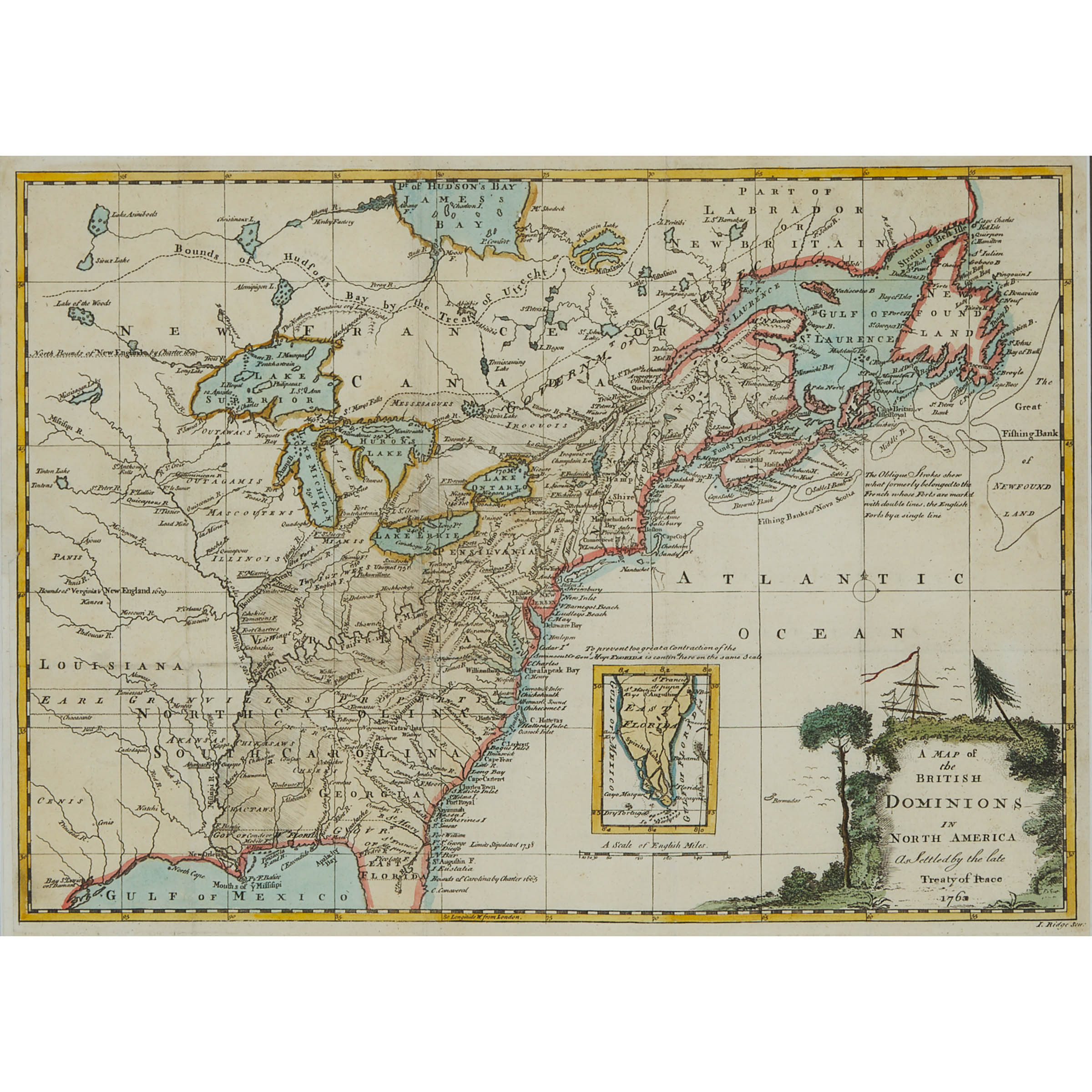
Lot 79 Details
John Mitchell (1711-1768)
A MAP OF THE BRITISH DOMINIONS IN NORTH AMERICA AS SETTLED BY THE LATE TREATY OF PEACE, 1763
hand coloured engraved map of the east coast of North America from Florida to Labrador, from Pierre François Xavier de Charlevoix's 'A voyage to North America', published by John Exshaw and James Potts, Dublin, 1766, framed
Sight 11.25 x 15.25 in — 18 x 22.25 cm; 18 x 22.25 in — 45.7 x 56.5 cm
Estimate $200-$300
Additional Images
Note:
The 'Mitchell Map' was reprinted several times during the second half of the 18th century and was used as primary source material during negotiations for the Treaty of Paris for the defining of boundaries in the newly independent United States. It remained important for resolving border disputes between the Canada and United States as recently as the 1980s during the dispute over the Gulf of Maine fisheries. The Mitchell Map is noted to be the most comprehensive map of eastern North America executed during the colonial era.